
The National Weather Service’s Climate Prediction Center issued an El Niño advisory and La Niña watch on Thursday. If La Niña, a pattern marked by cooler-than-normal water in the central and eastern equatorial Pacific, develops by summer, then it could play a major role in the upcoming Atlantic hurricane season.
“A transition from El Niño to ENSO-neutral is likely by April-June 2024 (79% chance), with increasing odds of La Niña developing in June-August 2024 (55% chance),” the Climate Prediction Center said, noting that there are already signals that El Niño is weakening. “Even though forecasts made through the spring season tend to be less reliable, there is a historical tendency for La Niña to follow strong El Niño events.”
La Niña pattern impacts on Atlantic hurricane season
A La Niña pattern tends to favor a more active Atlantic hurricane season since it decreases vertical wind shear, which is characterized by changing winds with altitude, over the Atlantic. When vertical wind shear is strong, it limits tropical cyclone development and strengthening by causing tropical systems to become titled.
Some indications are pointing to not only a strong La Niña pattern but also above-normal sea-surface temperatures in the Atlantic during peak hurricane season, which occurs from August to October. Warm ocean water is another factor that signals a potentially active season ahead, according to Philip Klotzbach, a Colorado State University meteorologist.
Additionally, there are signs of an active tropical wave train that could emerge from Africa during the heart of the season. Tropical waves move from west to east across the tropical Atlantic and, when atmospheric conditions are right, can develop into tropical storms and hurricanes.
Since it is still several months away from Atlantic hurricane season, which begins on June 1, there is room for variables to change.
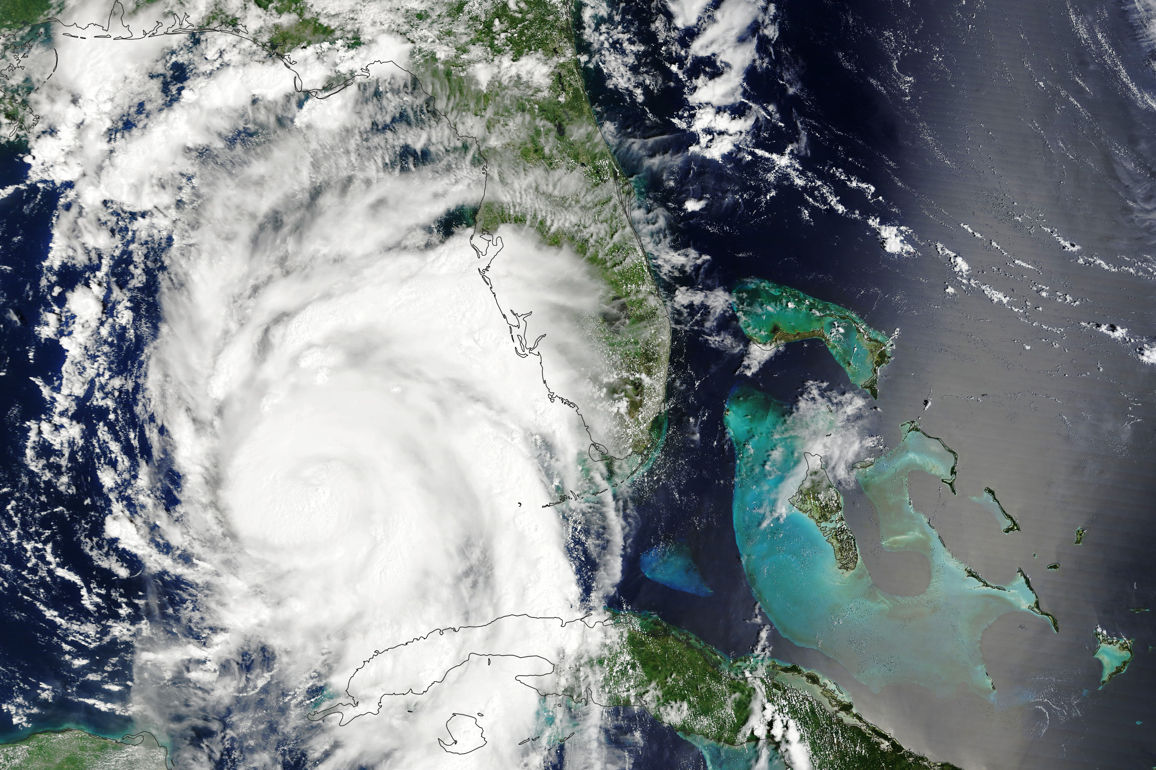
2023 was an active season even amid an El Niño pattern
The 2023 Atlantic hurricane season was an active one despite a strong El Niño pattern that was in place due to exceptionally warm ocean water in the Atlantic basin.
In 2023, there were 20 named storms, which ranks fourth in terms of the number of named storms in a year since 1950. Of the 20 storms that formed, seven became hurricanes, and three strengthened into major hurricanes — Category 3 or higher with winds exceeding 111 mph. In comparison, there are 14 named storms, seven hurricanes and three major hurricanes on average in an Atlantic hurricane season.
The three strongest hurricanes were Franklin, Idalia and Lee. Packing maximum sustained winds of 165 mph at Category 5-force, Lee was the most powerful hurricane of the season. It made landfall in Nova Scotia but also hammered the New England coast with towering waves, intense winds and torrential rain.
Hurricane Idalia left the biggest mark on the United States when it slammed into the Big Bend coast of Florida and caused destruction.
